Advanced Airborne Data Intelligence for Natural Resources, Infrastructure, and Environmental Protection
Aerovehicles provides advanced airborne remote sensing capabilities designed to monitor, analyze, and protect natural resources and critical environments, delivering high-resolution data across large and remote areas.

The Challenge of Monitoring Large and Remote Environments
Governments and industries face increasing pressure to monitor and manage natural resources, infrastructure, and environmental conditions across vast and often inaccessible regions.
Operational challenges:
Limited access to remote or difficult terrain
High cost of traditional aerial survey methods
Infrequent data collection and low temporal resolution
Dependence on satellite imagery with limited flexibility
Lack of real-time or near-real-time data
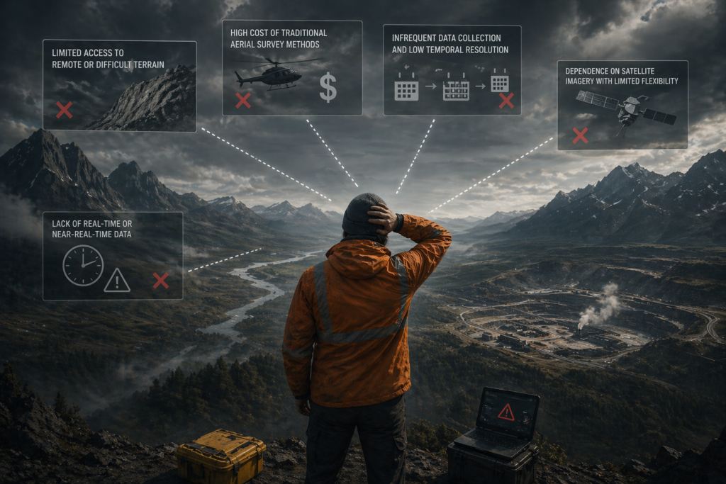
Environmental monitoring is often constrained not by data needs — but by the ability to collect it consistently.
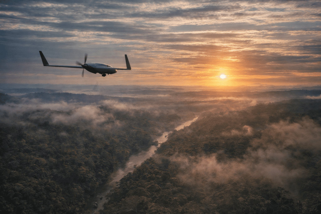
A Persistent Airborne Remote Sensing Platform
Aerovehicles introduces a new approach to environmental monitoring through persistent airborne data acquisition.
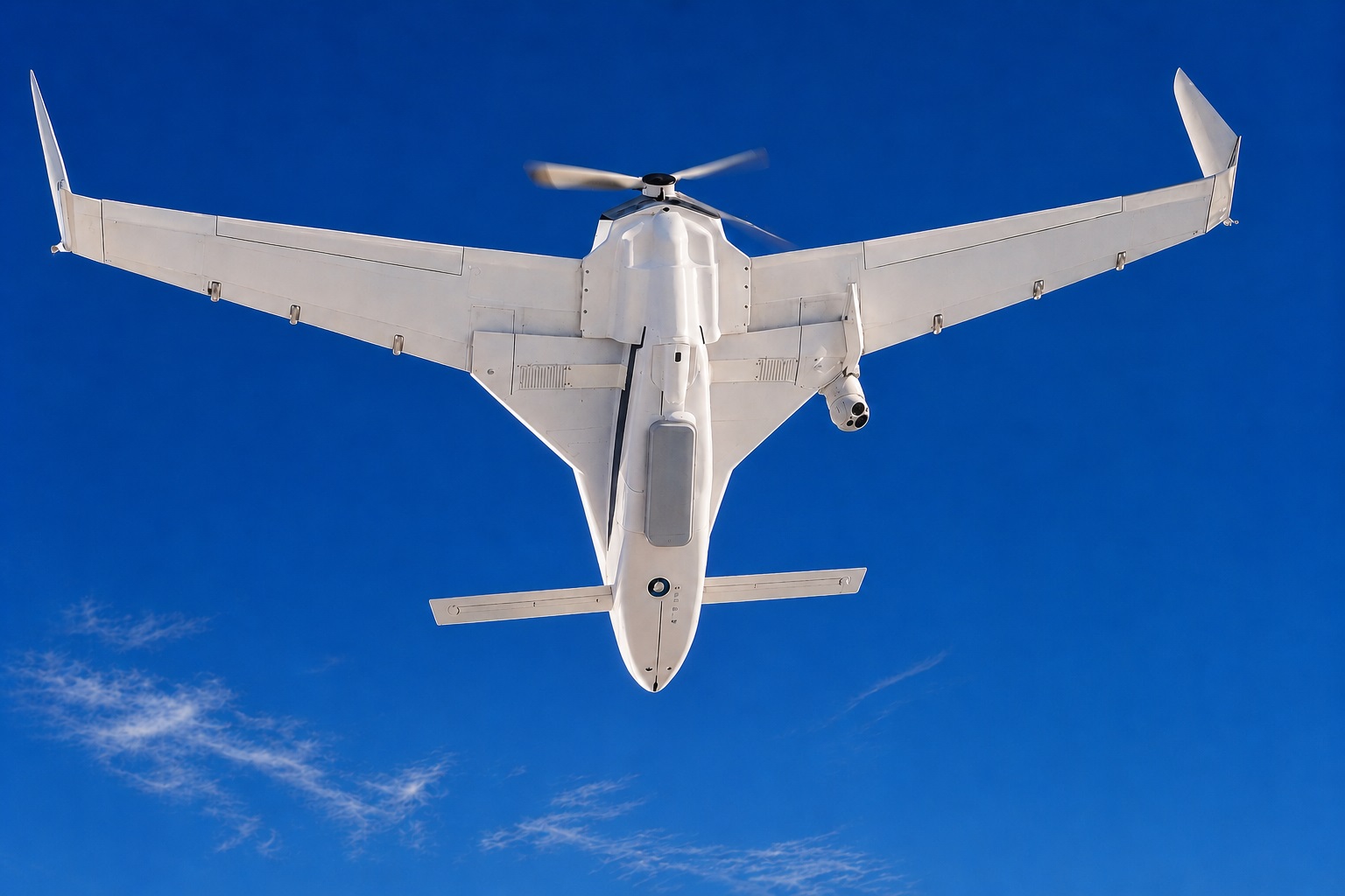
The Mobius OPV enables high-resolution, repeatable, and scalable remote sensing operations across large territories, providing consistent and actionable data for analysis and decision-making.

Persistent and repeatable data collection
High-resolution airborne sensing
Coverage of large and remote areas
Flexible mission planning and deployment
Optionally piloted (manned / unmanned) operations
Operational Capabilities
Long-range missions covering extensive areas
Multi-hour endurance for large-scale surveys
Payload capacity supporting advanced sensor suites up to 450 Kg.
Operation in remote and low-infrastructure environments
Repeatable flight paths for time-series data collection
Low Cost per Flight Hour – USD 240
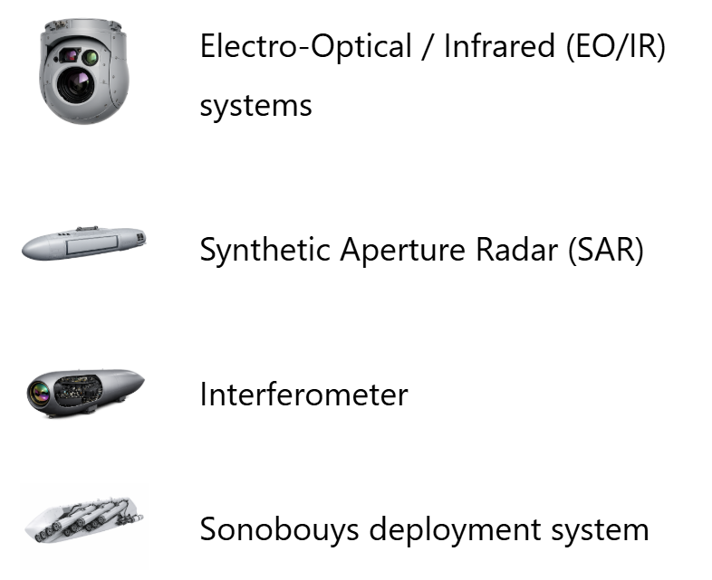
Advanced Remote Sensing Payloads
The platform supports a wide range of advanced sensors to capture detailed environmental and geospatial data.
Hyperspectral imaging (material and mineral identification)
Multispectral imaging (vegetation and land analysis)
LiDAR (topography, elevation, and 3D mapping)
Synthetic Aperture Radar (SAR) (all-weather imaging)
Electro-Optical / Infrared (EO/IR) systems
The system enables multi-layer data acquisition, combining spectral, spatial, and temporal intelligence.
From Data Collection to Actionable Intelligence
Environmental monitoring requires more than data acquisition — it requires consistent, high-quality datasets that enable analysis over time.

Time-series analysis and change detection
Identification of environmental trends
Early detection of anomalies and risks
Integration with geospatial and analytics platforms
Support for decision-making and planning
The value lies not only in data capture, but in the ability to generate continuous environmental intelligence.
Operational Use Cases
Natural Resource Exploration
Detection and analysis of mineral deposits and geological features using hyperspectral and geospatial data.
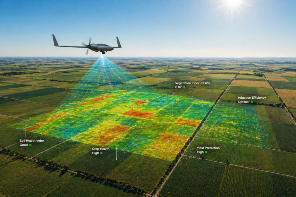
Agriculture and Land Management
Analysis of crop conditions, soil health, and irrigation patterns to support agricultural optimization.
Cadastral and Land Surveying
LiDAR-based mapping enables accurate terrain modeling and land boundary identification, supporting cadastral updates and large-scale land management initiatives.
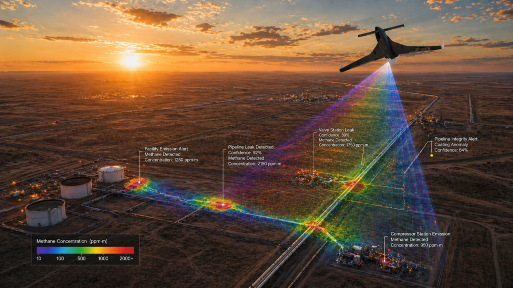
Oil & Gas Infrastructure Monitoring
Advanced airborne inspection and monitoring of pipelines, facilities, and operational environments using EO/IR, thermal imaging, gas detection sensors, and LiDAR for early detection of gas and oil leakages, infrastructure anomalies, and safety risks across remote energy assets.

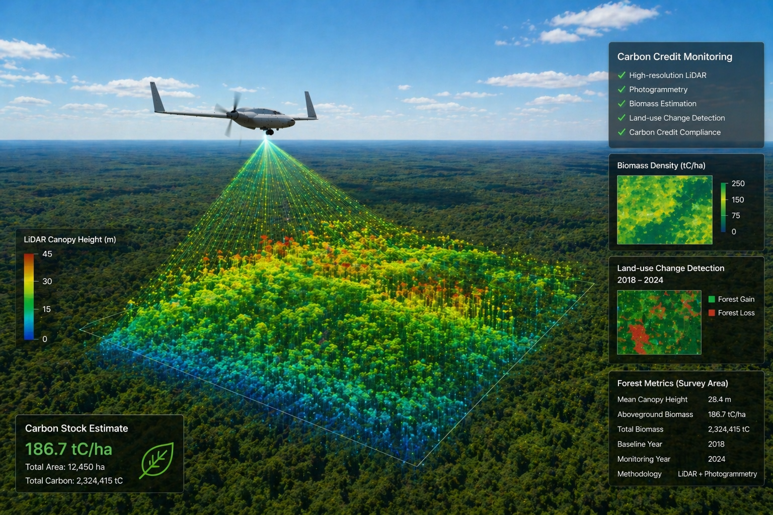
Carbon Credit Monitoring
High-resolution LiDAR and photogrammetry enable accurate measurement of biomass, forest structure, and land-use changes, supporting carbon credit certification and environmental compliance programs.
Environmental Protection and Compliance
Monitoring of protected areas, detection of illegal activities, and support for regulatory compliance.
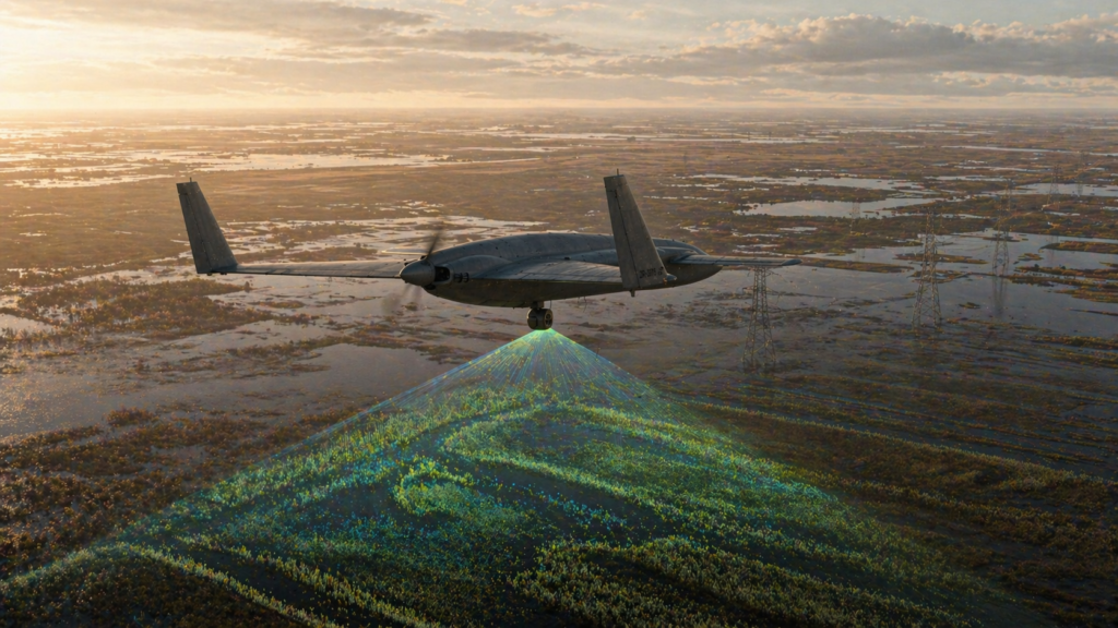
Flood Mapping & Hydraulic Planning
High-resolution elevation data generated through LiDAR enables precise identification of flood-prone areas, supporting hydraulic infrastructure planning and risk mitigation strategies.
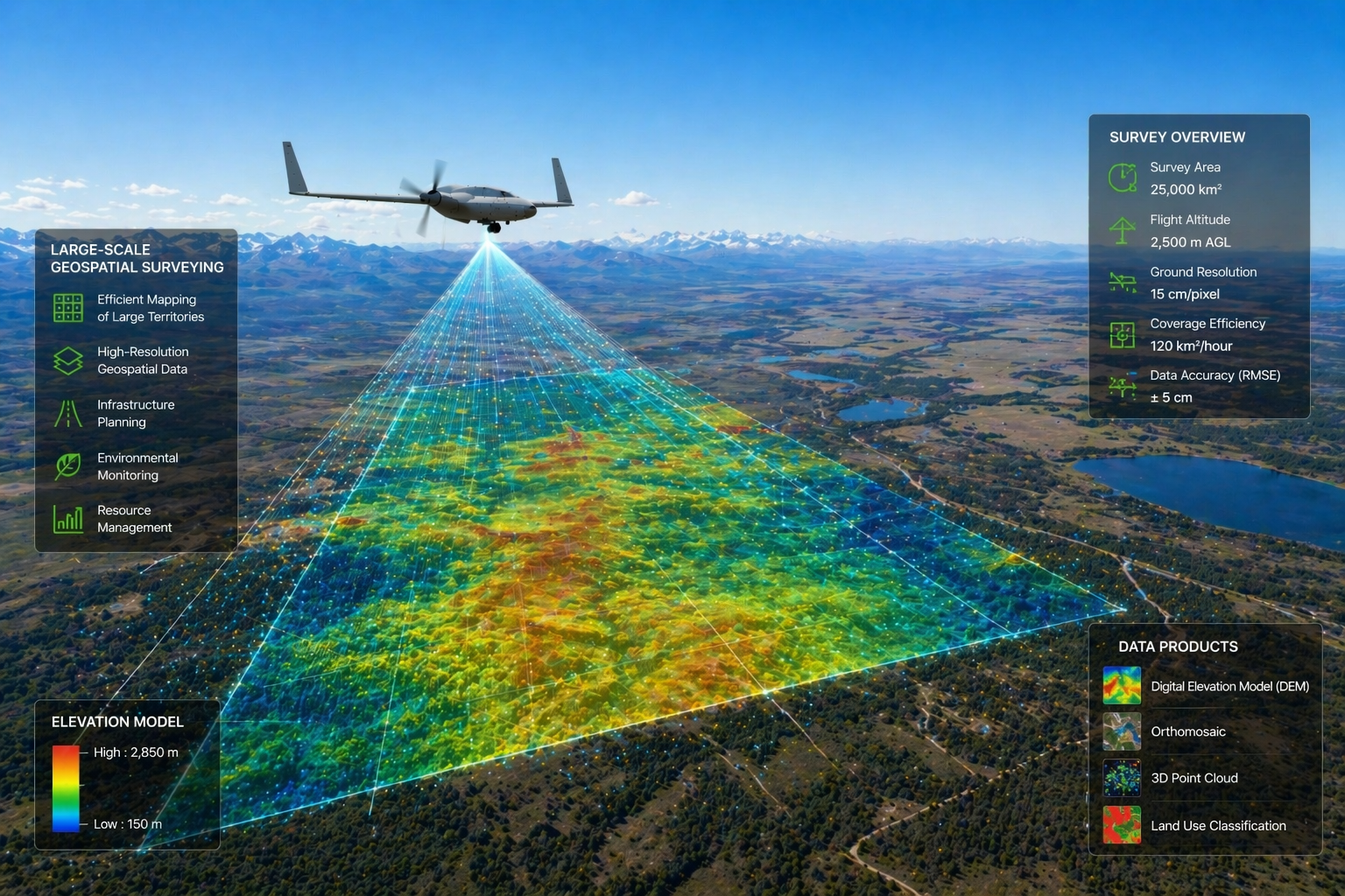
Large-Scale Geospatial Surveying
The platform enables efficient mapping of large territories, delivering high-resolution geospatial data for infrastructure planning, environmental monitoring, and resource management.

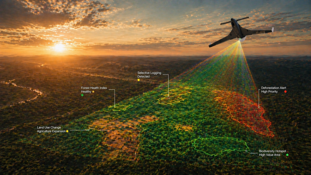
Forestry and Environmental Monitoring surveys
Monitoring of forest health, deforestation, and land-use changes across large regions.
Operational Advantage
One platform, multiple sensors, multiple surveys in one flight
Higher flexibility than satellite-based monitoring
Lower cost than traditional manned survey aircraft
Ability to collect data on demand
Persistent and repeatable coverage
Operation in remote and difficult environments
Positioning Within the Remote Sensing Ecosystem
Mobius OPV operates between satellite-based observation and traditional aerial survey platforms.
More flexible than satellites
More cost-effective than manned aircraft
Capable of persistent and repeatable missions
One Platform
Multiple Sensors
Every Survey Mission
The platform bridges the gap between space-based observation and high-cost aerial surveys.
Strategic Impact
Aerovehicles enables continuous environmental intelligence across large territories, improving monitoring capabilities and supporting sustainable resource management.
Improved environmental visibility
Enhanced resource management
Reduced monitoring costs
Better regulatory compliance
Increased operational efficiency
Engage with Aerovehicles
Contact our team to explore how Aerovehicles can support environmental monitoring and remote sensing operations tailored to your project and operational requirements.